Bird’s eye view: How satellite imagery is making the news
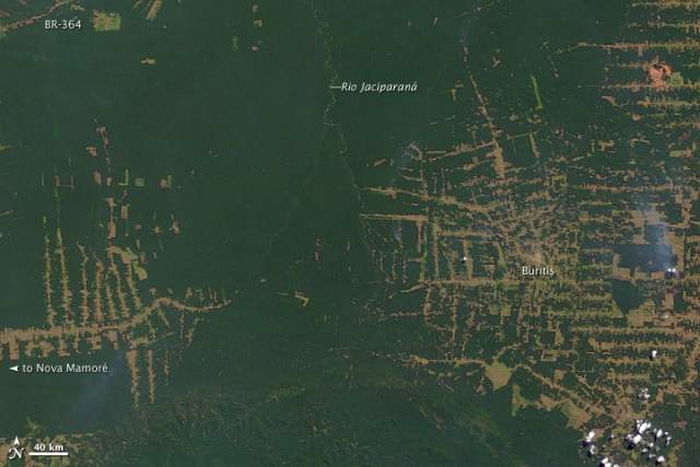
Deforestation in the state of Rondônia in western Brazil. (Photo: NASA)
In recent years, there have been a number of journalistic projects that made good use of the wealth of satellite imagery, which is increasingly freely available. (...) Global Forest Watch analyzes imagery from NASA satellites to find likely forest clearing activity every 16 days and sends out alerts that provide the latitude and longitude of the areas where the clearing was believed to have taken place. (...) Similarly, Info Amazonia makes available maps and datasets. A recent project visualized two years of forest fires in the Amazon using NASA satellite data.
But they also raise questions about the reliability of satellite imagery as proof and the ability of journalists – and their audiences – to make sense of them. Just like photographs, satellite images without context can distort the truth. And like photography, interpreting satellite imagery is as much art as it is science.
Read this article in full one The International Consortium of Investigative Journalists' wesbite
Categories
Latest news
- Indigenous Voices - Youth Training Videos
- LifeMosaic’s latest film now available in 8 languages
- การเผชิญหน้ากับการสูญพันธุ์ และการปกป้องวิถีชีวิต (Thai)
- LANÇAMENTO DO FILME BRASIL : Enfrentando a Extinção, Defendendo a Vida
- Enfrentando la Extinción, Defendiendo la Vida (Español)